News
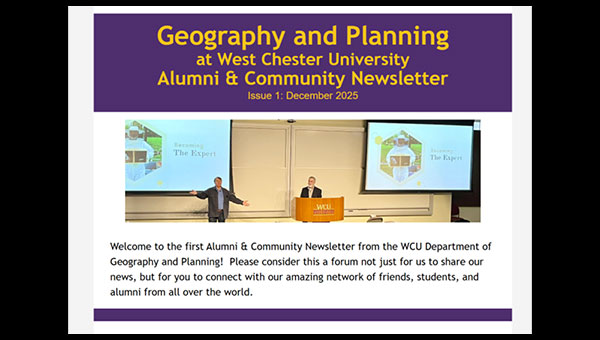
WCU Geography & Planning Department Newsletter (Issue 1: December 2025) Now Available
December 18, 2025
We are pleased to announce the launch of the WCU Department of Geography and Planning Newsletter! The December 2025 edition highlights recent faculty achievements, student accomplishments, research initiatives, events, and program updates across our planning, geography, GIS, and real estate programs.
We invite students, alumni, partners, and friends of the department to explore the latest news and stay connected with our growing community.
Access the newsletter here.
Faculty and Students Attend Esri Federal GIS Conference
February 11, 2026
Dr. Gary Coutu and students from WCU Department of Geography and Planning recently attended the Esri Federal GIS Conference (FedGIS) in Washington, D.C., one of the nation’s premier gatherings focused on Geographic Information Systems (GIS) applications in government, planning, infrastructure, environmental management, and public policy.
The conference brings together GIS professionals, researchers, and public-sector leaders to explore how spatial technologies support data-driven decision-making and real-world problem solving. During the event, WCU participants had the opportunity to meet Jack Dangermond (second to the left in the picture), founder and president of Esri, the global leader in GIS software and spatial analytics.
The experience provided valuable exposure for students to emerging GIS innovations, professional networking opportunities, and career pathways in geospatial and planning fields.

2nd Annual Real Estate Day Featuring Industry Leader Jeff DeVuono
The Department of Geography and Planning and the College of Business and Public Management are excited to host the 2nd Annual Real Estate Day, bringing students and faculty together with industry professionals to explore careers and emerging trends in commercial real estate.
This year’s event features Jeff DeVuono, Executive Vice President at Brandywine Realty Trust (NYSE: BDN), one of the region’s leading full-service real estate investment trusts (REITs). Drawing on nearly three decades of industry experience, DeVuono will discuss how major real estate firms make investment and development decisions, respond to evolving market conditions, and build successful careers in commercial real estate (CRE).
The session will cover how REITs operate, current market trends, development and leasing strategies, and career pathways within the commercial real estate industry—offering students valuable insights directly from a senior industry leader.
- March 3, 2026
- 2:00 PM
- CBPM Room 101
Students interested in real estate, planning, finance, and development are strongly encouraged to attend this unique experiential learning opportunity.

Bad Bunny performs during the halftime show at Super Bowl 60, February 8, 2026 in Santa Clara, Calif. Godofredo A. Vasquez/AP
Carlos Morales-Ramírez Featured in ABC News Coverage of Super Bowl Halftime Show
February 9, 2026
Dr. Carlos Morales-Ramírez, faculty member in West Chester University’s Department of Geography and Planning, was recently featured in ABC News’ Good Morning America coverage analyzing the cultural symbolism behind Bad Bunny’s historic Super Bowl LX halftime performance.
The nationally broadcast segment examined how the performance incorporated themes of identity, representation, and pan-American unity. Dr. Morales-Ramírez provided expert insight on the symbolic meaning of the Puerto Rican flag displayed during the show, explaining how variations in the flag’s blue color carry important historical and political significance connected to Puerto Rican identity and cultural expression.
Bad Bunny’s halftime show—performed largely in Spanish and viewed by more than 100 million audiences worldwide—highlighted Puerto Rican culture while emphasizing a broader vision of shared identity across the Americas.
This national media feature showcases the department’s growing impact in connecting geographic scholarship and cultural analysis to contemporary public conversations and global events.

Lecture & Q&A with Erick Guerra: Rethinking U.S. Highway Construction
The WCU Department of Geography and Planning and the Office of Sustainability are excited to co-sponsor a Lecture and Q&A with Dr. Erick Guerra, author of Overbuilt: The High Costs and Low Rewards of U.S. Highway Construction.
Dr. Guerra’s research examines how decades of highway expansion have shaped urban development, transportation systems, public spending, and community outcomes across the United States. The lecture will provide critical insights into transportation planning, infrastructure investment, and sustainable mobility policy—topics central to contemporary planning and urban development debates.
- Thursday, March 26, 2026
- 6:30-8:00 PM
- Business and Public Management Center, Room 116
This event offers an excellent opportunity for students interested in transportation planning, sustainability, and infrastructure policy to engage directly with a leading scholar in the field.
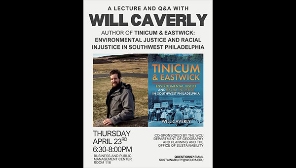
Lecture & Q&A with Will Caverly: Environmental Justice in Southwest Philadelphia
The WCU Department of Geography and Planning, in collaboration with the Office of Sustainability, is pleased to co-sponsor a special Lecture and Q&A with author Will Caverly, discussing his book Tinicum & Eastwick: Environmental Justice and Racial Injustice in Southwest Philadelphia.
This event explores the historical and ongoing environmental justice challenges faced by communities in Southwest Philadelphia, highlighting the intersections of planning decisions, environmental risk, race, and community advocacy. Caverly’s work provides an important regional perspective on equitable planning and the lasting impacts of infrastructure and land-use policy.
- Thursday, April 23
- 6:30–8:00 PM
- Business and Public Management Center, Room 116
Students, faculty, and community members are encouraged to attend this timely discussion on environmental justice and planning practice.
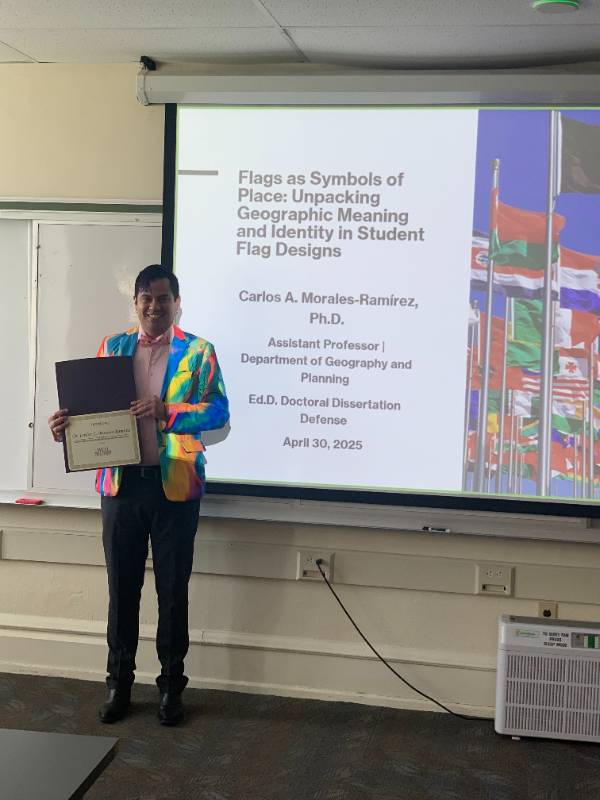
CARLOS MORALES-RAMÍREZ DEFENDS DISSERTATION, EARNS SECOND DOCTORATE
April 30, 2025
Dr. Carlos A. Morales-Ramírez, Assistant Professor in the Department of Geography and Planning, successfully defended his doctoral dissertation today, earning his Doctor of Education (Ed.D.) in Curriculum and Instruction. This achievement marks his second doctoral degree, complementing his Ph.D. in Geography from the National University of Singapore in 2022.
His dissertation, titled “Flags as Symbols of Place: Unpacking Geographic Meaning and Identity in Student Flag Designs,” explores the intersection of vexillology and geographic education. His dual-doctorate accomplishment underscores a profound commitment to both academic scholarship and pedagogical excellence.
Dr. Morales-Ramírez’s interdisciplinary expertise spans biogeography, geography education, and vexillology. His academic journey includes a B.A. in Geography from the University of Puerto Rico, an M.S. in Geography Education from the University of Oregon, and an M.A. in Geography from West Chester University.
For more information on Dr. Morales-Ramírez's work and upcoming publications, please contact the Department of Geography and Planning at West Chester University.

JONGWOONG KIM EXPLORES SUBURBAN HOUSING AND OFFICE VACANCY SOLUTIONS IN PLANNING MAGAZINE
April 17, 2025
Dr. Jongwoong Kim, Associate Professor of Planning, authored a new article in the Summer 2025 issue of PLANNING magazine. Titled “Unlock Suburban Housing Potential and Put Empty Offices to Work,” the piece examines innovative strategies for repurposing underutilized suburban office spaces into much-needed housing.
Using national-scale geographical and case analysis, Kim explores how local policy, financial incentives, and public perception shape the conversion of commercial properties into residential use. He highlights the potential of adaptive reuse as a strategy to alleviate housing shortages and revitalize suburban communities.
To read the full article, visit the American Planning Association’s website.

MEGAN HECKERT HIGHLIGHTS EQUITY IN URBAN GREENING IN BROWN POLITICAL REVIEW INTERVIEW
December 28, 2023
Dr. Megan L. Heckert, Professor of Geography and Planning and a graduate (2000) of Brown University, shares insights on sustainable urbanism and community engagement in a recent interview with the Brown Political Review.
Drawing from her experiences in the Peace Corps and her academic journey from aquatic biology to urban geography, Heckert emphasizes the importance of integrating environmental initiatives with social equity. She discusses the challenges of implementing green infrastructure in urban areas without displacing long-term residents, advocating for strategies that balance environmental benefits with affordable housing and community needs.
Heckert also highlights the role of Geographic Information Systems (GIS) in visualizing disparities and facilitating inclusive decision-making processes. To read the full interview, visit the Brown Political Review’s website.
WCU FEATURED FOR USE OF LOCATION ANALYTICS IN BUSINESS PROGRAMS
June 15, 2023
The College of Business and Public Management is proud to be featured by Esri in one of its user stories. Read about how the College of Business and Public Management is helping students get ahead and meet workforce needs by using location analytics in undergraduate and graduate programs. Link to the story: https://go.esri.com/wcu-location-analytics
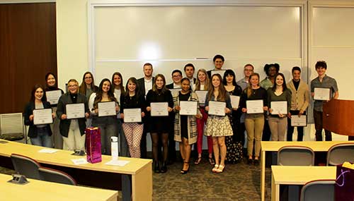
COLLEGE'S OUTSTANDING STUDENTS HONORED
April 28, 2023
The College of Business and Public Management hosted its annual Outstanding Student
Awards Ceremony on Thursday, April 27, 2023, recognizing a total of 29 students from
its programs for their outstanding accomplishments. The event honored 20 undergraduate
students, including students from WCU’s Philadelphia and DCCC Campus programs, and
nine graduate students.
The Outstanding Student Award is presented to both undergraduate and graduate students
in each College of Business and Public Management program. Each department or program
nominates and selects their award winner(s) based on criteria individual to that department.
Congratulations to the following students who were recognized by the Department of
Geography and Planning:
Outstanding Undergraduate Students
Department of Geography & Planning
Alexis Acey
Riley Nolan
Quinten Harrison
Kelsey Arrington-Podraza
Outstanding Graduate Students
Master of Science in Geography
Elpidio Guzman De La Cruz
Master of Urban & Regional Planning
Don Edmonds

JONGWOONG KIM RECEIVES 2023 KATHY A. POSSINGER HOUSING POLICY FELLOWSHIP
December 8, 2022
Dr. Jongwoong Kim, Assistant Professor in the Department of Geography and Planning, is a recipient of the 2023 Kathy A. Possinger Housing Policy Fellowship from the Pennsylvania Housing Finance Agency. Kim will receive a stipend during the year to conduct research benefiting the affordable housing industry. Kim's fellowship project will connect and analyze issues that are often discussed separately but have consequences from their combined impact on seniors: those are property taxes and aging-in-place.
Read the official Pennsylvania Housing Finance Agency press release for more information.

WCU’S BACHELOR OF SCIENCE IN URBAN AND ENVIRONMENTAL PLANNING RECEIVES ACCREDITATION
November 11, 2022
This past June, the Planning Accreditation Board (PAB) announced initial accreditation for West Chester University’s Bachelor of Science in Urban and Environmental Planning degree for a five-year term effective January 2023. WCU joins only 15 other undergraduate programs in the United States to be nationally accredited.
In its report, the review committee noted many areas of excellence including a notable strength in the use and application of technologies embodied in Geographic Information Systems (GIS), which is supported by a close linkage between program faculty and ESRI, faculty engagement in community and regional planning practices, and high-quality and energetic students who gain valuable real-world experience.
“The department has spent many years carefully developing a planning program that builds on the strengths of the Geography & Planning Department and the College of Business & Public Management,” said Dr. Dottie Ives Dewey, Associate Dean of the College of Business and Public Management and Professor of Planning. “Accreditation by the PAB is a great acknowledgement that our program aligns with the performance expectations, quality standards, and values central to the planning profession. We’re especially pleased that the PAB recognized the quality of our students, as they are the true testament of the quality of the program. We believe the B.S. in Urban & Environmental Planning program is well-positioned to continue to educate new planners and make lasting contributions to local communities in Chester County and beyond.”
PAB’s mission is to promote excellence among planning programs and ensure high quality education for future urban planners. PAB currently accredits 15 bachelor’s and 78 master’s programs at 81 North American universities. Accreditation by the PAB indicated that the program has undergone an external review and substantially meets the PAB standards and criteria. PAB bases its decisions on the overall quality of the program, its performance relative to its mission and strategic plan, and its performance relative to PAB’s five standards.
Accreditation (or a degree from an accredited program) serves as a marker of approval from the planning academy as well as the planning profession. Practitioners and employers view accredited programs highly in providing the core for professional education with commonly recognized standards for skills, knowledge, and values. Accreditation provides an assurance that a program’s graduates are well prepared for practice with the necessary skills and knowledge to effectively serve in the workplace and with the public. Graduates from accredited planning programs are also eligible for AICP Candidacy status immediately upon graduation.
While the Department of Geography and Planning had been educating planners for many years, the B.S. in Urban and Environmental Planning officially launched in Fall 2016 with the growing demand in the region and nationally. The curriculum equips students with the professional and technical skills needed to guide the complex processes of a changing world, to utilize modern technology to create a sustainable built and natural environment, and to enrich communities through leadership, entrepreneurial creativity, social responsibility and environmentally sustainable planning and policy. As of May 2022, the program has awarded degrees to 62 students.
“I think that the planning studio courses helped solidify that planning was the career path I wanted to follow,” said Patricia Quinn ’21, M’22, who is currently a Transportation Planner for the Chester County Planning Commission. “They laid out a structured but amenable roadmap for projects and students made the final product their own.”
The most recent 2022 graduation class has a 100% placement rate of either being employed or admitted to graduate school upon graduation. Employers include townships, counties, engineering services firms, GIS and technology firms, and not-for-profit entities including environmental organizations and community development organizations.
WEST CHESTER GEOGRAPHY AND PLANNING FEATURED IN ESRI USER STORY
West Chester University's Department of Geography and Planning is proud to be featured by Esri in one of its user stories. Read about how the department incorporates Esri’s software platforms into its courses, and especially how it was able to teach GIS during the pandemic.

LONG PRESENTED WITH MARSHALL AWARD
June 30, 2020
West Chester University graduate student Gabrielle Long was awarded the Lewis H. Marshall Award which is presented annually by the Chester County Association of Township Officials (CCATO) to a West Chester University student demonstrating academic excellence with a career intent to work in local government in Chester County.
Long, who earned a B.S. in Integrative Biology in 2018 and GIS Certification in 2019, recently completed her M.S. in Geography in 2020. She has served as a GIS Analyst and Parks & Recreation Ambassador for East Goshen Township.
The Marshall Award dates back to in or around 1972 and honors Lewis Marshall. Marshall served as the Secretary/Treasurer of West Goshen Township, CCATO, and a member of the Executive Committee of the Pennsylvania State Association of Township Supervisors.

ANDERSON EARNS CREW PHILADELPHIA SCHOLARSHIP
June 12, 2020
West Chester University graduate Melanie Anderson ’20 was recently announced as one of six recipients of a Commercial Real Estate Women (CREW) Philadelphia Scholarship. Anderson graduated this spring with her M.S. in Geography.
CREW Philadelphia awards annual scholarships to deserving local college and university women who are pursuing a career in or related to commercial real estate. The women chosen for the scholarships receive a monetary award, as well as benefits including membership in CREW Philadelphia and opportunities to attend Chapter and CREW Network events.
“Throughout my academic experience, I have completed many courses and projects that focused on sustainability,” Anderson said. “My passions are in sustainable economic development that prioritizes the best interest of the people and our natural environment.
“As an Urban and Environmental planning major, I have learned about the importance of community engagement, planning history and ethics, population geography, and land use planning. As a graduate student, I have gained more experience in GIS and data analytics. I hope for a career in commercial real estate where I can apply all these skills to assist in creating a place that will be representative of all values of sustainability.”
CREW Philadelphia is the commercial real estate industry’s premier business network dedicated to supporting the achievements of women in commercial real estate. They have more than 180 local members who are engaged in all facets of commercial real estate. CREW Philadelphia is one of 75 local chapters of CREW Network. More than 11,000 CREW Network members represent nearly every discipline within the industry and are located in over 70 major markets across the globe.
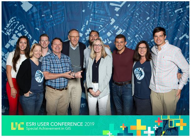
INNOVATIVE USE OF GIS NETS INTERNATIONAL AWARD FOR GEOGRAPHY AND PLANNING
July 24, 2019
West Chester University’s Department of Geography and Planning was honored with a Special Achievement in GIS (SAG) Award during the annual Esri User Conference, held in San Diego, CA, this summer. More than 19,000 professionals, educators, and students attended the conference.
WCU was one of only three institutions of higher education that received an award out of 178 institutions acknowledged this year in fields spanning local government, agriculture, environmental analysis, emergency response, retail, and water management. Esri’s annual SAG Awards recognize select organizations from around the world that are using geospatial technology to solve pressing challenges and those setting new precedents and innovation in the use of GIS.
Calling the award “a fantastic honor,” Gary Coutu, WCU professor of geography and planning, noted that the department received the award for its innovative use of GIS and 3D modeling for facilities mapping and management of campus. A WCU team created a virtual reality model of campus to allow a user to “walk around” campus as a tour and to envision new campus buildings, public space, and review tree growth, over time, across campus. A web-based scene of this application was produced to share these visualizations across the internet. Seven students who worked on specific aspects of the 3D project were Kevin Hazley, Morgan Sapia, Jason Karian, Kyle Erisman, Rich Simpson, Tyler LaMantia, and Eric Quinn.
Graduate assistant Sapia also assisted Coutu this summer with creation of a 3D image and map of the interior of the Business and Public Management Center, where the department and GIS lab are located. Working with Matthew Waychoff, building information architect at Philadelphia-based mobile capture and computational modeling company StartingPoints.xyz, they used a handheld LIDAR camera to capture imagery that is being integrated into their current 3D model of the building. It will be online later this semester.
Individual buildings are also being modeled for office and classroom management. This includes a QR code-enhanced building management application that allows facilities personnel to inventory a room and create a work order to request maintenance. The next application of the indoor models will be for emergency response and delivery management.
“West Chester University has a special relationship with Esri,” notes Coutu. “We use the entire suite of their software and it is part of our education, research, and management activities. Our in-depth knowledge of GIS software and geospatial software has given us the opportunity to work closely with Esri solutions engineers: We have served as beta-testers for some of their software. Students come to WCU to learn GIS because of our reputation and relationship with Esri. Eight of our alumni currently work at ESRI headquarters in Redlands [CA] and we have about 10 other alumni at ESRI Philadelphia, Washington, D.C., and Denver. It is exciting to be associated with a company that is so innovative and committed to action on local and global issues.”
Esri, the global leader in location intelligence, builds ArcGIS, the leading mapping and spatial analytics software for desktop, software as a service (SaaS), and enterprise applications.
WCU’s project deployed this tech: ArcGIS, ArcGIS Pro, AGOL, CityEngine, Collector, Survey123, Workforce, Business Analyst, Community Analyst, Geoplanner, ArcGIS 360 VR, and ArcGIS Indoors (beta).